Space-inspired innovation brings hyper-accurate soil insights to American farmers

For more than 80 years, traditional soil testing methods have remained largely unchanged. Typically, soil cores are extracted from the ground and sent to a lab for testing and analysis. The process is time intensive, expensive, and faces resolution challenges especially across large land tracts. While much of agriculture has made huge technological advancements, soil testing methods have seemed stagnant – until now. One company, EarthOptics, is changing that.
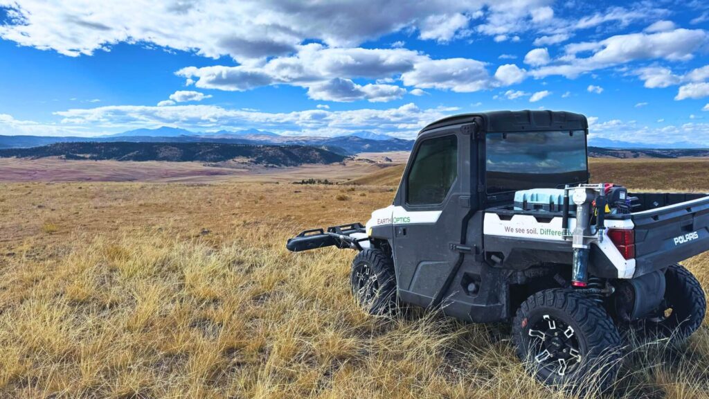
The EarthOptics GroundOwl™ sensor suite scanning for carbon in Colorado
A look at Martian soil
EarthOptics began studying soil data retrieved from the Mars Opportunity rover and the Insight lander, both of which were providing groundbreaking insights on the attributes of Martian soil. This led the company to a pivotal question: Why were we using such advanced technology to learn about soil on Mars, but not applying similar soil innovations to benefit American farmers?
Back to Earth: Launching the first multi-sensor soil suite
Drawing from research into space exploration technologies, EarthOptics became the first company to launch a multi-sensor suite delivering hyper-accurate and high-resolution soil data on Earth. Unique to EarthOptics is their integration of multiple sensors into an array, a soil sensing technology named GroundOwl™. This industry-first approach to combining sensor capabilities allows the company to collect and analyze soil data more comprehensively and accurately than ever before. For example, traditional crop management gathers 40 soil data points per 100 acres on a 2.5-acre grid. Using its sensor technology on the same scale, EarthOptics collects 4,000 data points – a 100-fold leap in resolution.
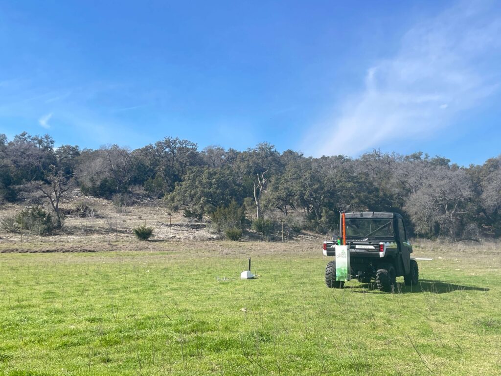
EarthOptics measures carbon and nuclear bulk density in San Antonio, Texas
Turning Data into Action
Farmers can often be overwhelmed with data. EarthOptics offers farmers data that easily translates into actionable results. Using the GroundOwl™ proprietary sensor technology, farmers gain critical insights into their soil’s nutrition, compaction, carbon, and moisture. Now farmers can know where to treat and where to save; where tilling is needed and where it’s not.
The GroundOwl payload scans a field, mounted on an ATV, side-by-side, or tractor. The sensors, combined with advanced artificial intelligence (AI), build a digital twin of the soil in the cloud. This technology measures soil variation, generating more data points in a field than any other soil analysis method. EarthOptics verifies accuracy in the field by taking a small number of dense physical soil samples. After GroundOwl sweeps the field with its sensors, the data is transferred to a machine learning platform, which produces hyper-accurate, high-resolution maps of all soil attributes. Using machine learning combined with artificial intelligence, over time fewer physical samples are required to achieve high accuracy.
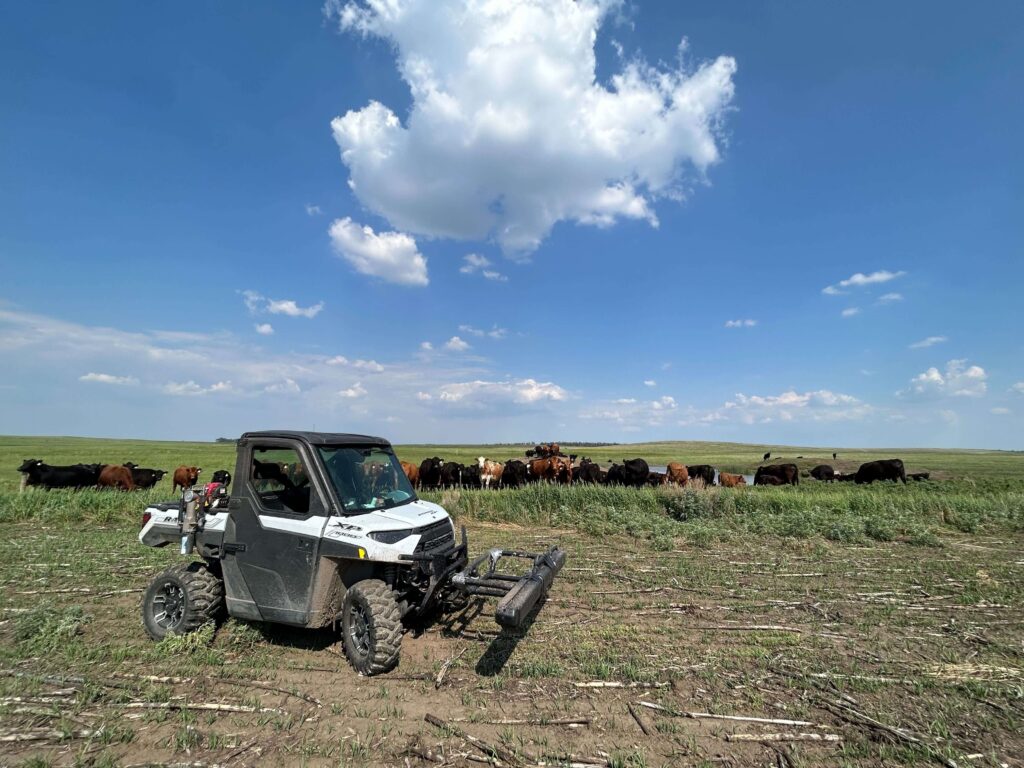
EarthOptics scans for carbon in North Dakota
The Breakthrough Technologies
Farmers and professional service providers access their soil information through the SoilMapper platform, which integrates the scanned and sampled soil data for comprehensive insights across key soil attributes:
TillMapper™: Measures and maps soil compaction, reducing tillage. Farmers receive a tillage prescription (brand agnostic) on where and how deep to till, reducing input costs and saving time.
NutrientMapper™: Shares nutrient data in meters rather than acres to show insights into variability. It measures CEC (Cation Exchange Capacity), potassium, phosphorus, pH, and nitrogen.
C-Mapper™: Provides data and analysis on soil carbon levels, moisture, and organic content.
From Mars to Earth, new EarthOptics technologies are bringing valuable high-resolution soil insights to farmers while saving on cost and boosting operational efficiency. To learn more, visit EarthOptics.com.